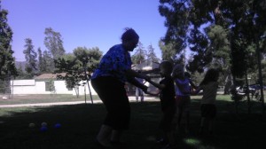
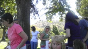
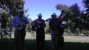
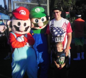
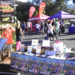
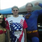
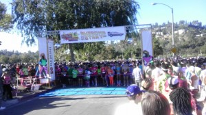
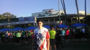
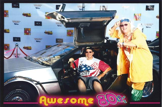
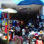
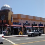
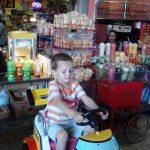
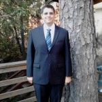
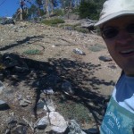
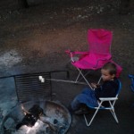
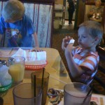
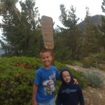
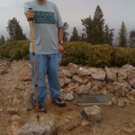
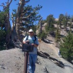
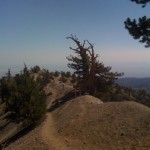
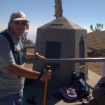
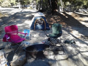
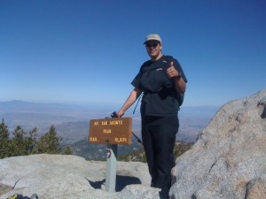
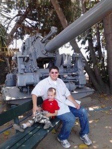
These are pictures from a recent mini-family renunion we had in Los Angeles. I meant to write more about it but ran out of time, but I still wanted to post the pictures…
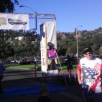 Training for a marathon has been a long journey. It has been 10 months now of training and I have seen some really good results. If you go by just the numbers they are impressive (at least I think they are). From the beginning of the year I have run/walked/hiked 800.6 miles in a 157 hrs. (that is the equivalent of 6.5 days of continual movement), and burned over 150,000 calories by exercise. Through all this work I have lost 96 pounds in the last year (107 from my very highest).
As impressive as all of this work has been every once in a while I find myself still needing to test myself out to see if I am truly still on track. Throughout the year I have done this in various ways. To test my distance endurance I have done two official half marathons this year, to test my hill climbing I jogged up Mt. San Jacinto (second highest peak in Southern California), and this weekend to test my speed I signed up for the Totally Awesome 80s 10K Race in Pasadena.
I picked this race because the course looked pretty flat and it also looked pretty fun. First and foremost I don’t think I have ever seen that much neon in one place ever. Not even in the 80s! The pre and post race party was very fun. Lots of people were dressed in costume, they had the deloreon from Back to the Future, lots of fun 80s music, vendors, taco trucks, fun contests, and the finishers medal was shaped like a cassette tape which I thought was cool. I have nothing but good things to say about the pre and post-race parties.
The race itself was not as fun. A 10k for those not on metric is equivalent to 6.2 miles. There were about five thousand runners there and so they had to let us out in waves. They let the 5K racers go first, but a lot of 5kers are slow, so it took about an hour before the 10Kers were let loose. I was in the second wave of 10k racers. The course was flat so I was able to go at a good pace, but I was having a hard time passing up 5kers. The course was very narrow and to get around people I had to go into the street which did not make the police happy, they barked at me on their speakers every time I passed a slower runner. I did a personal best on the course, but I think I could have done better if I was not zig zagging so much. There was only one water station on course and it ran out of water, which because of our late start was bad because it was hot. I think as far as the running part went a lot of people did not finish.
Luckily for me, I did finish. Despite the setbacks I was still able to do a personal best. I finished in an official time of 1hr. 2 mins. and 36 secs. (a 10:06 /min per mile pace). I came in 389 of 1073 of the timed finishers. This put me solidly in the top third of the race! Looking at my pace calculators it also tells me that I am running at a good enough speed that I can reasonably expect to finish my full marathon in under 5 hours (11:30 /min per mile pace), which is exactly where I want to be and that is awesome!
Whenever I tell my co-workers I am going to go down to Baja they kind of give me this shocked look. If I talk about the subject long enough they will inevitably start questioning my duty to my family. I can’t really blame them, they are just trying to help. Afterall, Baja is a dangerous place. Everyone knows that Baja California is not a place for Americans to travel. Why else would the government put up that big tall fence with all that barbwire if “those” people weren’t so bad? A quick view of the news outlets or a google search will quickly prove the folly of going south of the border. Always remember, you may get robbed, get caught up in a drug war, or worse have you heard people have been drown in acid?!! Apparently people (like myself) have not been getting the message so I have decided to do a bit of public service and list my top reasons on why you should never go to down to Baja California.
1. It is dirty and dusty…
Yep, it sure is dirty and dusty in Mexico. I can’t even begin to tell you how bad the skyline can get in Baja California. One morning while we were there the clouds rolled in and I could not see out to Islas Mujeres. Can you believe it?! Oh and then when I was running along the beach in the morning I went for 4 miles and there was sand and dirt everywhere and the beach sweepers didn’t even do anything about it.
2. You might get assaulted…
They all told me it would happen. The lady on the phone was so bold as to actually give me the time and place as to where it would happen. Yep, they beat me up for about an hour, took my money, and then had the audacity to smile and told me to comeback so they could do it again. The nerve of them!
3. The food is horrible…

I managed to restrained myself just long enough to take this picture. As good as the lobster was, I think the homeade flour tortillas almost stole the show.
As soon as we got down there on Friday all these Mexicans kept on telling us to eat. We knew it must of been a plot so we walked around a bit to try and find out what was going on. Alas, it was to no avail because we were quickly ushered into one of these deceptive dining establishments. We should have known when everyone was smiling that they were up to a nefarious plot, and they were! Yep, the gave us spiny crustaceans!! It was hard to swallow it all down, but we didn’t know what they would’ve done if we didn’t finish it.
4. Those Mexicans are always blaring loud music…
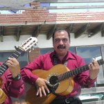
For about $5 a song (or 5 for $20 if you bargain a little) you can have all the music you want. My favorite to play to Denise is "Sin Ti".
Yep, it’s true. Wherever we went there were music. The trumpet guys were definitely the loudest. As if to brag about it some of them actually wore black suits with big hats and shiny buckles. When we were painstakingly eating our fried crustaceans the owner of the restaurant actually let a couple of them in. It was tough listening to them while we ate, but you know, we did our best and stuck it through.
5. The plumbing is horrible…
It was close, but Friday night we almost lost AJ to the bathtub. The kid was in there for like a half an hour. I think they were trying to bleach him, because when he did come out he was like 5 shades lighter. How he didn’t just wrinkle up into nothingness is beyond me.
6. Going to a foreign country can be so expensive…
Oh yeah, you know that’s right. You should have seen the money I was laying down for stuff 12 pesos for a taco and 35 for a cup of ice cream. 10 for a liter of juice. 65 for a folk dance show. I was throwing out such high numbers I nearly lost count.
7. The accommodations are horrible…
I guess this kind of goes along with everything being so dirty, but the buildings are all made of tile, and you know what tile is made out of right?! You got it, dirt!! Dirt on dirt, and they expect you to sleep in that. The nerve of those people.
8. There security is too restrictive / too lax…
I know they were watching me… They even had binoculars. I kept running along the beach but there they were watching me, and they wanted me to know they were there, they were in red. It was really weird too, I think I was about to discover something really nefarious. I saw this sign that said “peligro” and as soon as I got too close they told me I had to go. I am not sure what was over there, I guess I will never know.
9. You might get caught up in a protest…
Mexico won the gold for soccer in the Olympics and everywhere we went the police kept blocking off the streets because the people kept having impromptu celebrations. All peaceful but they still mucked up the traffic.
I guess it was bound to happen. On Saturday morning the police started blocking the streets. It was hard to figure out what was going on. It seemed to be a really big street gang had taken over the streets. They all had the same green shirt with a soccer ball on it. There were a lot of big Mexican flags being waved and they were all shouting “Mexico gano el oro!” I wasn’t sure about everything else they were saying but I know that oro means gold. They kept saying they were going after the gold. Quickly realizing I had a gold wedding ring on I knew it was time to find a way back across the border.
10. The family doesn’t really want to go…

It doesn't take much to convince Denise to go to Baja. All I really have to say is "OXXO" and "Belight Mango" and she is onboard.
I don’t know how poor Denise gets roped into all my follies. Oh well, I guess that is just the dedication and patience she has for me. Gotta love being married to such a patient wife.
Anyhow, you should know that we are back now. Safe and sound in the good US of A. It was rough but we did make it back into the land of safety. Now we might go back again one day, but we want you to know that you should not go. We only go down there as a kind of public service to other Americans so they will not have to suffer the pains that we do. Always remember if you go to Mexico something bad might happen. You might get robbed, you might get caught up in a drug war, or something else even worse!! You just never know…
I really don’t like buying clothes. I don’t consider myself a fashionable person. The number one of the reasons I don’t like buying clothes is because it is expensive. Second, I am not really sure these days where my clothes come from. And finally, I find the clothes shopping experience a rather dull experience. Losing weight however has forced me to overlook these differences and find new clothes.
The last time I bought a suit I went to the Men’s Warehouse. I got a grey suit and an extra coat for about $500 dollars. It was a good suit, but being the klutz that I am, I ended up ripping up the pocket of the suit. Not once, but twice! I was able to get it tailored the first time, but by the second time it looked pretty bad. A short while later I got lucky and my father-in-law gave me once of his old suits. I wore that for awhile, but soon I lost so much weight that it too didn’t look right. Doing some research I started to read up on some seemingly unbelievable deals in downtown Los Angeles. Suits for as low as $50 dollars, dress shirts for $10, and could a silk shirt really be sold for only $20?!? I knew there had to be a catch, but the prices were so low that I felt I had to at least check it out.
The main business for the LA Fashion District is retailers. Clothes, fabrics, electronics, toys, etc. come in from the nearby San Pedro Docks and the wholesalers store them in the LA Fashion District.Monday through Friday most of the stores in the LA Fashion District are only open to retailers, but on Saturdays some of the wholesalers open to the public. This over the years has spurred a mass open market like event in downtown Los Angeles. Armed with a map that I downloaded off the Internet I soon found out that the LA Fashion District is laid out like a giant department store (as if department stores were 10×10 blocks wide). All the the stores of a like type are conveniently grouped together. If you want men’s suits you go to the men’s suits row. If you want kids wear there are five blocks of stores waiting for you, etc., etc. In addition to wholesalers, there are also weekend retailers that setup makeshift shops within the alleyways. The two biggest alleys are called the Santee Alley and the New Alley. It was interesting talking to all the sellers. Basically you find out that almost anything you thought was made in the USA is really not. Not that I didn’t know that, but it is interesting to find out how much a label really costs.
Going to the LA Fashion District is far from a dull experience. If you can’t stand crowds and don’t like pushy salespeople I suggest you stay far from this place. However, if you are the ultimate shopper, want a lively cultural experience, and are not afraid to haggle, THIS is the place for you! As I stated before, mostly due to the price, the LA Fashion District is bustling with people. There is street level parking, but it is virtually impossible to find. In our case we settled for $5 dollar all day lot parking. The majority of the shoppers were Hispanic, but I saw people from almost every slice of California (which is to say almost everywhere). Most of the stuff you buy from the street sellers is very cheap knock off stuff, but the wholesalers had some really nice quality goods. There was food, there were music, there were lights. It was a lot of sensory overload, but it was fun.
So, the main question is how did we make out. Well, my main objective in this expedition was a new suit. I ended up buying a Caravelli Black two button classic suit from a store called Al Weiss Inc. The label said Italian suit, but looking closely at the label and speaking with the sales guy I learned the suit was designed in Italy, but it was actually made in China. It is a good suit, with a nice lining. The suit, two dress shirts (white and light blue), and a tie ended up costing my $130 dollars. Around the corner from the store I found a tailor who measured it up and fitted it for $5 dollars (in less than an hour), parking was another $5, and AJ couldn’t keep his hands off the bubble guns so that cost me another $5 dollars. So in total it was $145 dollars (which includes tax). Not too bad, in this economy. For a little extra excitement we went to nearby Little Toyko and had fun going through the shops and eating noodles. Oh, and if your wondering what I think the next fashion trend is going to be, I say hold on to that flannel because I see a whole lot of grundge coming to market…
(click to enlarge the pictures)
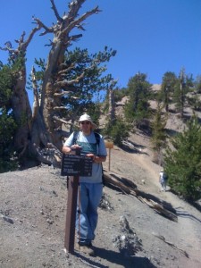
Just before the peak there is a trail switch to the Pacific Crest Trail that takes you to Mt. Burnham.
When I was 12 yrs. old I was a member of Troop 894 out of Chula Vista, California. We were a part of the San Diego Scout Council. My scoutmaster at the time was a retired marine and he really liked to hike. The last time I climbed Mt. Baden Powell I was 12 yrs. old. It was my first official hike with the troop. About a month previous to the hike I did a training hike up Stonewall Peak to prove to the troop that I was worthy of Mt. Baden Powell. At that time we came up the Mine Gulch trail. I don’t remember much, but I did remember the mine at the beginning of the trail, the monument at the top, and my first experience with a trail register.
It was with these memories that I made my second trip up Mt. Baden Powell. Whereas before my troop went up the more remote Mine Gulch Trail route, this time I went up the more popular Vincent Gap trail. Normally I like to get out on the trail as early as possible, but due to logistics I didn’t get on the trail until 8am (7/14/12). By that time the sun wasn’t too bad, but later coming down I would pay for being late on the trail by hiking in the heat.
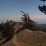
The last .3 miles of the Baden Powell Trail is very impressive as you walk across the spine of the mountain.
The trail itself is well maintained. There are vault toilets at the trail head, but they are not well maintained and don’t even lock. The beginning of the trail has a lot of switch backs, but there are plenty of good resting places along the way and signs marking 2 and 3 miles. About .3 miles from the top you turn a sharp corner and start walking along the spine of the mountain. With 100 ft. drop offs on both sides of the trail there is no temptation to deviate from the pass. Walking along the spine you wonder how anything could grow up there, but almost in defiance of that thought you are confronted with some really old knotty pine trees growing right into rock basin. At the end of the spine there is a cutoff for the PCT (Pacific Crest Trail).
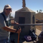
My thought upon seeing the Baden Powell monument was "Who in the heck would lug all that concrete up here?!"
My goal for this hike was Mt. Baden Powell. On my little guide map, it listed the 4 mile hike as a hard hike. With Mt. San Jacinto in my mind I told Denise to come back for me around 2pm. I ended up reaching the summit at 9:30 am. I got out my cellphone when I reached the top, but like most remote areas I had no reception. I did try to send out a text message from the the top, but it didn’t actually get to Denise until 7pm. Knowing there was no car in site for several hours and having a fair amount of energy in me I descended back to the PCT and decided to see how far I could get.
How far I could get was about a mile and a half down the trail to the Peak of Mt. Burnham.
In case your wondering who Burnham was he too was scout. Major Frederick Russell Burnham, was a explorer and scout who was known to advance scouting in two continents (which two I don’t know because I failed to read the rest of the wikipedia article). The top of Mt. Burnham was about as obscure as his fame. If it wasn’t for the help of some Sierra Club members I would have easily mistook the time spur trail as a deer trail and not have gone up the slope. There was not much at the top, I looked for a marker to confirm where I was but only found a bunch of brush. Luckily I had my GPS watch on me so when I got back I was able to confirm that I was indeed on top of Mt. Burnham.
Going back down the trail was interesting. At first it was hard because in order to get to Mr. Burnham I had to descent down the PCT, so to get back to the spine I had to ascend again. Coming down the switch backs was easy I had a really good pace. I passed a lot of hikers still climbing the trail. I don’t know what time they started but I wouldn’t want to be hiking up any mountain trail at 12pm. When I was about .3 miles from the trailhead I encountered a brown labrador coming up the mountain. Trying to be courteous to any uphill climber I moved off the trail to let the dog pass. I am not sure what was up with the dog but it didn’t like me and started to bark at me. At that point I got back on the trail (didn’t want to fall off a switchback) and raised the pointed end of hiking stick at the dog. The owner at this point was coming around the bend and said “what are you doing?!” My reply was “please control your dog!”, my thought was “if you can’t follow the rules and keep your dog on a leash, you have no recourse if I end up hurting your dog.” Don’t get me wrong I like animals. I don’t want to hurt any animal, including a dog, but when you’ve just hike for 10 miles the last thing you want to encounter is a barking dog off it’s leash. I would also like to say that along the way I saw 4 other dogs on the trail and they were all on leashes and they were all very polite (if you want funny, just wait until you see a boxer with a backpack on).
Other than the minor dog incident, the trail was pretty easy. I wouldn’t call it a beginner hike, but it wasn’t something one would have to train too hard for. I saw all sorts of people hiking the trail. I saw kids as young as 6 and met a guy who told me he was in his 70’s. What I didn’t see were people carrying a lot of water, which made me worry a bit for them. I carried 2.5 liters of water, which is a bit overkill (but I like to be prepared), but I saw a lot of people with nothing more than a 500 ml bottle which I thought was too little. Then again what do I know, I didn’t hear of any major mountain rescues that day so it couldn’t have been too bad. I got back to the trail head at 12:35 pm. Luckily I had a book in my daypack and there was a bench at the trail head. Denise never got my text messages but she was there at 2 pm to pick me up.
Keeping up with my marathon training I got these stats from my GPS watch:
I meant to write about this trip back in July that we did with our friends the Harris’, but I totally forgot. At least I documented some pictures which I am going to put in for posterity…
Not many people I know are excited to call themselves overweight, but I am!! As of this morning (7/8/12) I weighed myself at 220.8 lbs. For my height this puts me at a BMI of 29.9 which just barely pushes me out of the obese category and into the overweight category. Statistically this is significant because it means I am now at a much less risk of heart disease and type 2 diabetes. Not that I have ever had any signs of those diseases, but considering my family history I didn’t feel like taking any chances.
I started this (it is certainly not the first time I have tried to lose weight) round of weight loss in November 2011. When I started I weighed 305 lbs. which put me in category 3 obese. Basically, that meant I could have a heart attack at any minute. I suppose there are many reasons why I was obese, but they don’t really seem to matter much these days. I had a lot of strange thoughts of dropping dead one day and having doctors just writing it off as another obese death.With those wonderful thoughts in my head I started walking in September of 2011, but it wasn’t until November when I started tracking my weight again.
My main weapon of choice has been a little smart phone application called Lose It! The two main things I like about this app is that it is very portable. You can use it on almost any device (smart phone, internet, tablet PC) you can think of which is good because it means it is always nearby. The second thing is the application has a great database. Rarely do I not find a food listed on their database and if I do by some chance find something not listed it is very easy to add it in. Also in it’s favor is an easy interface and it gives you very detailed nutritional reports of the foods you have been eating. It is not a end all be all solution. It doesn’t tell you what food to eat. It wont tell you to get up the morning to go running. It just tracks, but it does that very well.
As far as motivation goes I found it easier to have lots of micro goals. In total I am trying to lose 122 lbs. That is a way to big number for me to conceive. I have been breaking down my weight loss goals in 10% goals which roughly has translated into 20-30 lbs. As a monetary incentive Denise and I have said that for every 10% we lose, we can have $50 dollars out of the family budget to spend on ourselves. The monetary incentive has been nice, but it really hasn’t motivated me to do much. The really motivation for me lately has been running. In striving for my weight loss goal I have added in my bucket goal of running a marathon. Having fainted back in 2007 when I did my first half-marathon I know the dangerous of not preparing well. For me there is a lot of motivation in not collapsing in the middle of the raceway. Not exactly sure why, but everyone has to find their own motivation.
So far it has been an interesting journey. I get a lot of complements which is nice, but it makes me think of what they were thinking before I started losing weight. I get a lot of people commenting to me about running. I don’t know why but it seems like everyone wants to tell me how bad their knees are. I used to have bad knees, but losing 85 pounds has seemed to make them better. I get a lot of people’s personal success stories. I like those great and small. I can spend a whole day watching other people’s youtube videos about weight loss. I don’t see a lot of guy videos though. I suppose I should start a guy video series on youtube. I bet I would get a lot of views. Anyhow, there is still a long way to go but I am now over half way there. Here is to getting out of the overweight category!
As a scout leader you would think I (John) would be the one to push the family into the great outdoors. Ironically, however when it comes time to pick my outings the thought never really crosses my mind. I think this is due to the fact that as a scout leader I get all the outdoors I ever want. I go on about 4 campouts a year with the boys and that is all I really need. Denise however doesn’t seem to think this is enough and has proposed we go out monthly as a family. I am not sure really sure of her motives on this new fascination, but camping is pretty cheap and if she likes it so be it.
When Denise first proposed the idea of going camping she diligently looked up the prices and found out pretty quickly that campsites are not as cheap as they used to be. A few years ago we made a run of several National Parks and were generally able to find campsites in the $10-$20 dollar range. What we found however in our research is that in California camping is not so cheap. The lowest California State Park camp fee we could find was about $27. Denise was determined and found out that on National Forest Land the prices are much cheaper, and that is how we decided to camp at Fern Basin. At only $10 per night (it will cost you a one time fee of $9 if you want to reserve ahead of time), it was definitely the way for us to go.
The campsite was simple. It had vault toilets. There was water onsite but it was not potable. The location of the camp however was nice. It was right next to the Marion Mountain trail and only 6 miles from Idyllwild. We had reserved our spot early, but coming in on a Thursday we noticed that there were still some non-reserved spots.
The first night we were there was pretty much all about setting up. Friday morning was a bit of a challenge as we tried to cook breakfast. It took us a long time to cook those eggs. Since Denise was really excited to go camping I didn’t really ask her much about how she was going to do things. Trying to light charcoal with no lighter fluid is not an easy task. We did however get the water to boil and breakfast was served. For lunch we packed sandwiches and set off to find Humber Park where the Ernie Maxwell trail starts. A nice easy 5.2 roundtrip hike, the Ernie Maxwell trail lived up to it’s scenic name. Going along the edge of the National Forest boundaries we had great views of Mt. San Jacinto and the valleys of Idyllwild. We ate lunch on the trail but had plenty of appetite left for desert. Lucky for us Idyllwild has a great little dessert shop and we enjoyed old fashion dipped ice cream bars. After our ice cream bars AJ said we had to go to the toy store. Denise and I didn’t really know what he was talking about, but AJ insisted there had to be a toy shop. It took some looking but sure enough we found a toy shop. The toy shop was interesting because not only did it have toys but it had a big collection of bottled soda. I particularly enjoyed the lemon creme soda. For dinner we had chicken chili which was a lot easier to make because before we left town we bought lighter fluid.
The next morning I left early to hike up Mt. San Jacinto, Denise and AJ stayed in camp. After about 7 hrs of hiking I returned to camp. By that time Denise had packed up everything and we headed back down the mountain in our little car. On the way home we stopped in Beaumont which was fun because with all the hiking I did I could eat as much as I wanted and so I ordered the biggest chile relleno burrito I could find.
All in all our first monthly campout went well. We had lots of fun even if we returned rather dirty. We learned a few things (like we need a bigger tent), but most of all we did it. Which for us is half the battle.
Mt. San Jacinto is the second largest peak in Southern California (San Gregornio is the first). I suppose having graduated from Mt. San Jacinto College it was altogether fitting that one day I would one day hike up Mt. San Jacinto. In order to do this however one has to find Mt. San Jacinto. You would think this would be a no brainer. Just go to San Jacinto and climb the highest mountain right?! Wrong, in fact as fate has it Mt. San Jacinto is kind of far away from the city of San Jacinto. Not terribly far, but considering the amount of walking one would have to do from the city of San Jacinto to Mt. San Jacinto it wouldn’t be worth the effort (not to mention some of those highway crossings might be a bit tricky).
I mention the route up to San Jacinto because depending on the route taken it can really change one’s experience. For those with money the quickest way up is probably the Palm Springs Aerial Tram. For $24 dollars per person you will get up to 9,000 ft. in just a few minutes and make the final 1,800 ft. up on a slightly ascending 5 mile trail. If money isn’t in the budget, but you have some time you can go up the mountain from Idyllwild and maybe camp overnight in one of the many campsites along the trail. Devil’s Slide Trail and Deer Spring Trail are very popular choices. Then there is the Marion Mountain trail. At 5.25 miles (6.5 if you are like me and go all over the place), the Marion Mountain trail is the shortest way up to the San Jacinto Peak. When I got my wilderness permit (permits are free but required on all trails) for this hike the lady told me “you know this is a steep trail right?” I told her I would be ok because I had a walking stick, but it was a very steep trail.
Going up the trail I had a few limitations. The first and foremost limitation was time. According to the campsite rules we had to leave the site by 2 pm. A generous checkout time, but it didn’t leave me much climbing time. I set my ipod alarm for 5:00 am and I left the campsite (Fern Basin, $10 per night) by 5:15 am. I also set another alarm for 12:00 pm, which was my absolute return time. It is always good to set an absolute return time if you are limited on time because it can get away from you. I have some really good Scarpa hiking boots but after hiking in them a few miles it turns out I bought them too small and so I had to do the trail in my Asics running shoes. It was nice to have light shoes on the trail, but for the steep parts and the rocks I didn’t have much tracking (it was a good thing I had that walking stick). As far as a backpack goes I just had my daypack. I was only going to be out for the day, but I always bring enough gear with me so that if I had to I could spend the night. For example I brought along 3 litters of water, when I only really needed 1 (maybe 1 1/2). It makes me feel better to be a bit over-prepared and the overpreparedness gives me confidence to be more adventurous.
The trail was tough, but it was a very beautiful hike. The first 2.5 miles was the Marion Mountain trail. Very steep but filled with a lot of trees and nice overlooks towards Hemet. Beyond the Marion Mountain trail was the Pacific Crest Trail and the Deer Springs Trail. At this point the trail got a bit easier, but the trees went away so there was not much to look at, but that was ok because there were lots of streams that cut the trail so it was important to be careful (or get really wet).
The rock formations were interesting. I went through the middle of these two rocks thinking "please let there not be an earthquake right now."
Coming off what seemed be a lot of switchbacks was Little Round Valley. This was to me a .25 section of paradise. There were a lot of people camping in this section and I had fun talking to them. There was also this little creek that I hung out at that was very idyllic. Out of Little Round Valley Campsite there was a one mile section of switchbacks that were not too steep but at this point the air started getting thin to me, so it caused a bit of strain. At the end of the last switchbacks the trail connected with the end of the tram trail for a rock-hopping .3 miles to the peak.
I got up to the peak around 9:30 in the morning. It turned out to be a good time to get there.
There were not a lot of people on the trail yet and I was free to explore without a lot of people in the way. At about 10:30 I started going back down the mountain and saw a lot of people making the last of their ascents. When I got to the switchbacks I noticed a decent amount of people also coming from the tram trail.
Coming down the trail was not as strenuous as going up, but it did take almost about the same time as it did to go up the trail. Especially in the last part of the trail I had to watch it so that I didn’t go sliding. I think this is where a good set of hiking boots would have come in handy. I did my best and took it slow and was eventually able to get back at camp at 1 pm.
One day I would like to hike the entire PCT (Pacific Crest Trail) or the AT (Appalacian Trail), but today is not going to be that day. However, in the spirit of getting there someday I am glad I took the chance to go up Mt. San Jacinto. For a detailed map of my ascent along with my times and elevation gains please click HERE.
So, you’ve decided you want to make Rambo 5 and you are not sure where you are going to go to get all those tanks you are going to need for that next all American action classic. Or, maybe you just decided you are going to have a Panzer roll into your child’s birthday party but you don’t know which model will create the correct amount of havoc and mayhem. Have no fear! I have found the place for you, the American Military Museum in South El Monte, California is the place for you. Boasting the largest collection of military tanks in an inter city enviroment the American Military Museum plays to the over macho warrior in all of us.

